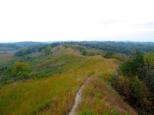
We drove a scenic byway through one section of the hills to the little town of Moorhead. There, at the hospitality center, we picked up maps and brochures, and asked questions of the very helpful volunteer. We then headed southwest on 183 along the eastern edge of the hills to Preparation Canyon, a state park. Much of this park is quite rugged and accessible only by hiking so we sort of skirted the edge. From there we were going to head to Pisgah and the visitor's center but took a detour to a 'forest overlook.' After a couple of wrong turns, we reached a large wooden platform built to provide panoramic views on three sides. Many of you know I don't do heights, but I did manage to get some nice photos, including the one above.
Back to 183 and what we thought was but a few miles to Pisgah. Not to be. We ran into closed road signs with no detour. Our options were to return to Onawa and take I-29 south or charge off on our own at the previous gravel road heading west and hope to find another route south. This is not like eastern and north central Iowa where country roads divide the countryside into one mile squares. We rejected a couple of possible routes that were labeled 'Level B Maintenance,' which in DOT speak means NO maintenance. Finally after a number of miles, twists and turns, and spectacular scenery, we reached an actual stop sign and were able to head back south and right into Pisgah.

https://www.youtube.com/watch?v=FxYetCEFomU
We wended our way back to camp in increasing rainfall, got in decent naps, and took the laundry in to the Dirty to Pretty Clean. Big day!
 RSS Feed